Address
5650 Elko Road
Sandston, VA 23150
Geo Coordinates
37.508667,-77.240611Description
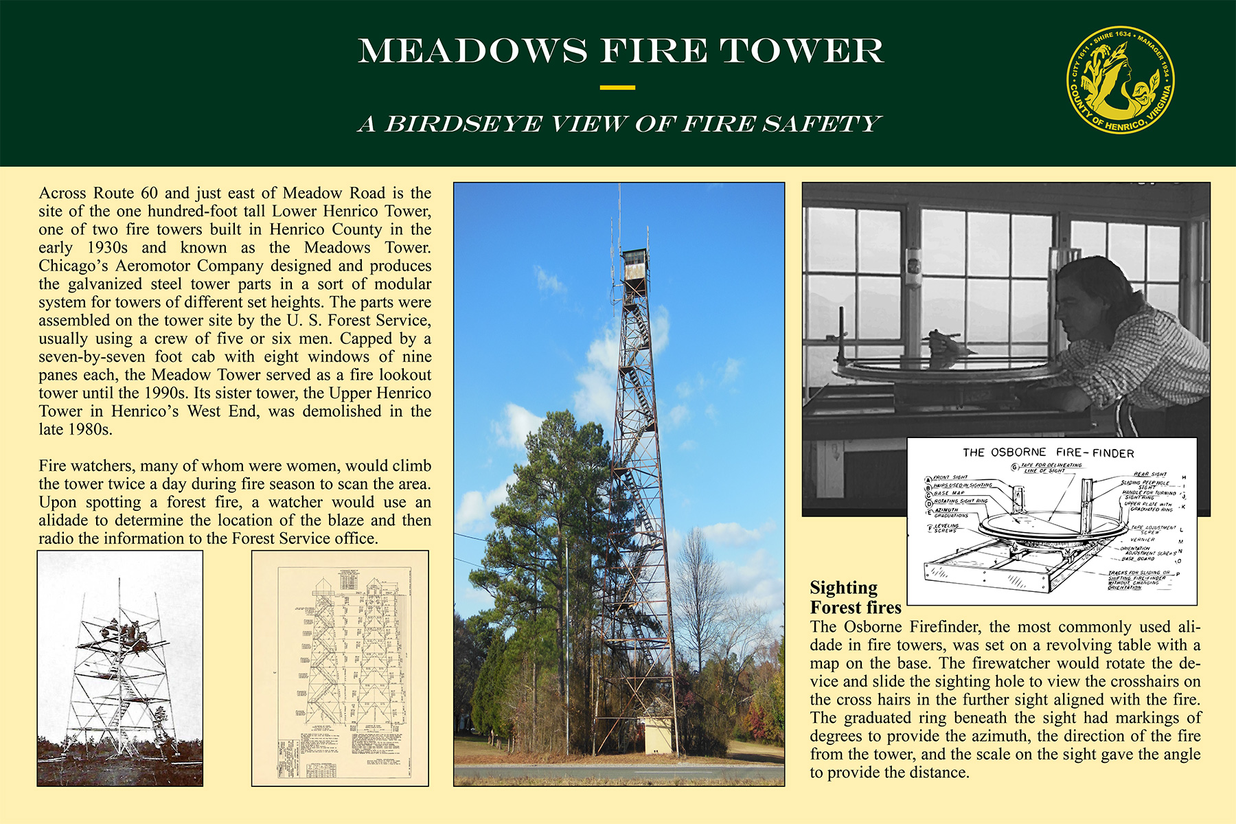
Across Route 60 and just east of Meadow Road is the site of the one hundred-foot tall Lower Henrico Tower, one of two fire towers built in Henrico County in the early 1930s and known as the Meadows Tower. Chicago’s Aeromotor Company designed and produces the galvanized steel tower parts in a sort of modular system for towers of different set heights. The parts were assembled on the tower site by the U. S. Forest Service, usually using a crew of five or six men. Capped by a seven-by-seven foot cab with eight windows of nine panes each, the Meadow Tower served as a fire lookout tower until the 1990s. Its sister tower, the Upper Henrico Tower in Henrico’s West End, was demolished in the late 1980s.
Fire watchers, many of whom were women, would climb the tower twice a day during fire season to scan the area. Upon spotting a forest fire, a watcher would use an alidade to determine the location of the blaze and then radio the information to the Forest Service office.
Sighting Forest Fires
The Osborne Firefinder, the most commonly used ali-dade in fire towers, was set on a revolving table with a map on the base. The firewatcher would rotate the de-vice and slide the sighting hole to view the crosshairs on the cross hairs in the further sight aligned with the fire. The graduated ring beneath the sight had markings of degrees to provide the azimuth, the direction of the fire from the tower, and the scale on the sight gave the angle to provide the distance.