

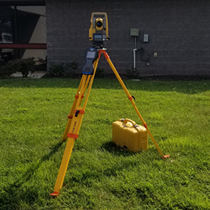
The Survey Group of the Design Division is composed of two, three-person crews. They are responsible for providing any surveys necessary for maintaining and updating Henrico County’s roadway and drainage systems.
What is Survey?
Surveying is a technique of measuring to determine the relative positions of points above, on, or below the earth’s surface. Surveying is as old as civilization and its origins can be traced back to the Egyptians, who used surveying to reestablish property after flooding by the Nile River.
Elevation Certificates
On August 9, 2023, FEMA released the updated Elevation Certificate and Dry Floodproofing Certificate (2022 Edition). These are the new, current version and must be used for all Elevation Certificates and Dry Floodproofing Certificates signed and submitted on November 1, 2023 or later. Additional information is available in FEMA’s August 9, 2023 Memo.
NOTE: If you get a “Please Wait” error when trying to view the Elevation Certificate form, it is due to some incompatibility issues with Adobe PDFs and the alternative PDF viewer used by certain browsers. To view the document, download the file to your computer and open it using your system viewer. You may need to install the free Adobe Reader to view the document if you use a different PDF viewer and still experience issues.
The Survey Group does not create Elevation Certificates for private properties. Private property owners must contact a private survey or engineering company to perform this service.
The County has limited records of Elevation Certificates for private property in the County. To find out if the County has an Elevation Certificate on file for your property, please contact the Floodplain and Dam Safety Manager. If you have an existing Elevation Certificate for your property, please consider sharing it with the County to help us build our Elevation Certificate database.
Surveying my Property
While the County cannot perform survey on private property unless it is for a County project, you will be notified if the County must perform a survey within a public easement located on your property two weeks prior to the survey. If the County is surveying in the right-of-way adjacent to your property or on a public easement located on your property, you can contact the County Surveyor at (804) 727-8288.
Henrico County Geographical Information System (GIS)
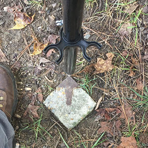
As an integral part of Henrico County’s GIS, more than 140 high-accuracy survey monuments were installed throughout the County to support GIS. These monuments are three feet tall and are made of precast concrete with a brass cap. Stamped in this brass cap are the words “Henrico County Monument,” the year of installation, and a unique identification number. View more information on Monumentation.
What does the Survey Group do?
The Survey Group DOES:
- Perform survey for County projects, including topographic survey, boundary survey, construction stakeout, construction survey, and geodetic survey
The Survey Group DOES NOT:
- Perform surveys on private property unless the survey is done within the County Right-of-Way and Public Easements
- Make recommendations of private survey companies to residents, but you can use the Virginia Association of Surveyors “Find a Surveyor” tool
- Create plats for right-of-way vacations. Private property owners must contact a private survey company to create this plat
- Create Elevation Certificates for private properties. Private property owners must contact a private survey or engineering company to perform this service

